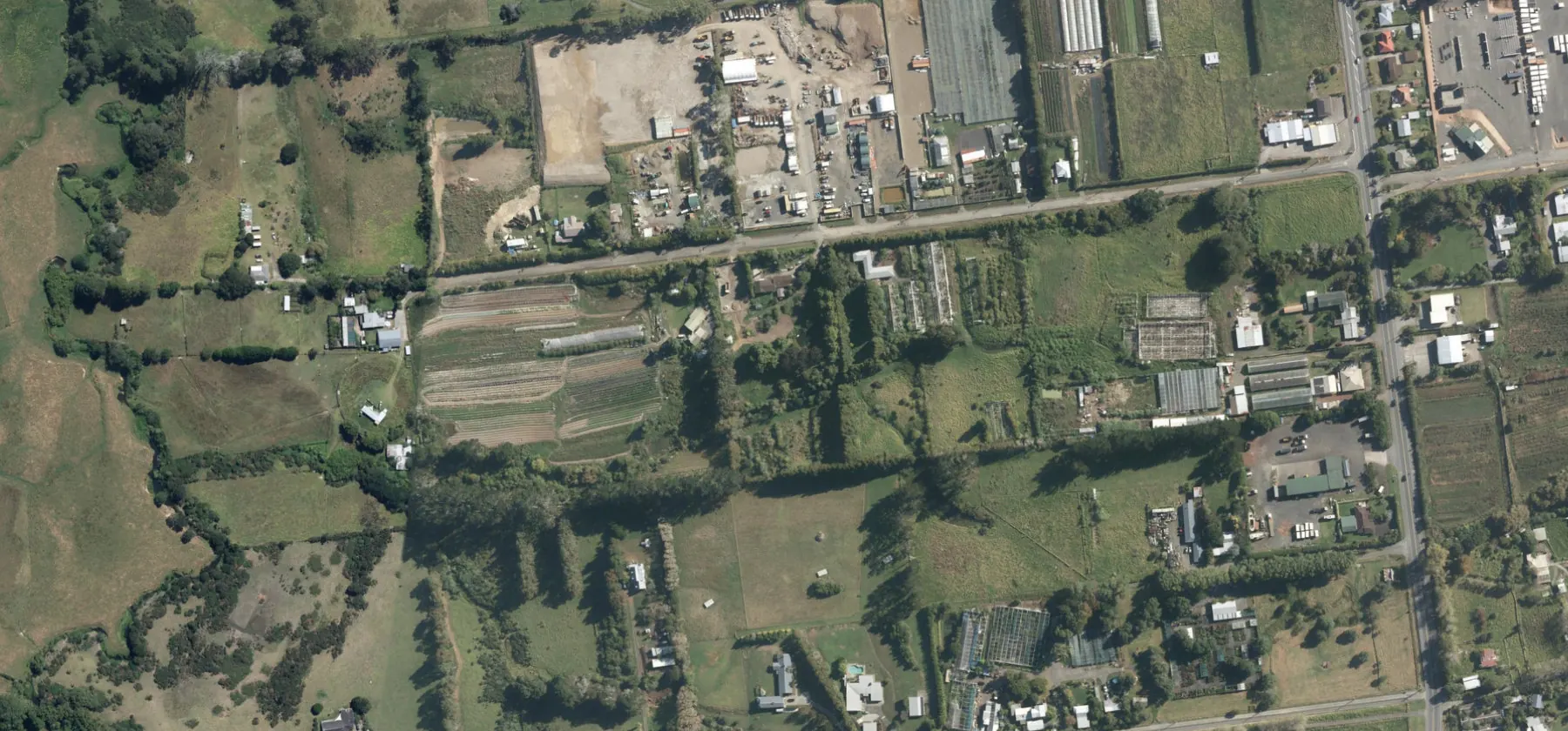
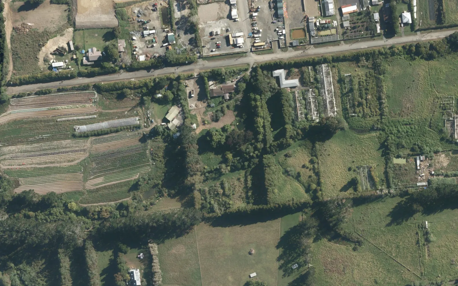
Future Urban land on Hailes Road, Whenuapai, forming part of our development portfolio in Auckland’s northwest.
Hailes Road is close to Fred Taylor Drive and the Redhills growth area, where thousands of new homes are planned or under way across Precise on Fred Taylor, Universal Homes’ West Hills and Hugh Green Group’s Rua Hills.
Spedding Industrial sits between SH16 and SH18, and Westgate and NorthWest provide a regional centre for retail, dining and services.
Land area is a reported property measurement. Potential lots and Proposed Building Areas* are illustrative scale comparisons, not approved plans. Building Areas means ground-level footprint, not total floor area. Area sources Disclaimer
The offering.
Land, planning and the next chapter.
Hailes Road is part of our Whenuapai land portfolio. We coordinate the site assessment, planning and development approach around its individual setting.
From planning and consents to subdivision and construction, we bring practical building knowledge to each stage of the development journey.
Hailes Road · Aerial site context · Eagle Technology / LINZ. Boundaries are not shown.
Development potential.
A reference study drawn from the neighbouring 41–43 Brigham Creek Road scheme. These are indicative scale comparisons, not a site design or approved yield.
The reference.
41–43 Brigham Creek Road July 2025 S92 response · Revision 1 196 scheduled lots; numbering extends to 208.
Gross site area
51,921 m²
Proposed residential lots
196
Building footprint
14,547 m²
Residential lot land
33,591 m²
How the comparison works.
16,187 ÷ 51,921 × 196 ≈ 61 potential residential lots*. The same gross-area ratio applied to the reference building coverage gives approximately 4,500 m² of proposed building footprint*.
The reference density is approximately 37.7 lots per 10,000 m² of gross site area, with building coverage of approximately 28.0%. Its residential lot land is approximately 64.7% of the gross site. For this project, that ratio illustrates approximately 10,500 m² of residential lot land before site-specific design.
Density sensitivity · all figures indicative*
Illustration
Reference density
Potential lots*
Proposed Building Areas*
Lower density illustration
80%
~49
~3,600 m²
Mid density illustration
90%
~55
~4,100 m²
Reference density illustration
100%
~61
~4,500 m²
* Illustrative calculations only, using the 41–43 scheme’s gross-site ratios. Proposed Building Areas means ground-level building footprint (coverage), excluding upper-floor area; it is not GFA. Figures are rounded, not surveyed, designed, consented or guaranteed. The density illustrations are sensitivity assumptions, not a feasibility range. Zoning, road designations, roads/JOALs, stormwater, flooding, ecology, ground conditions, servicing, setbacks and the eventual design may materially reduce yield or area. No approved subdivision or building consent is claimed for this site. The reference includes six bespoke lots with building area TBC, so its coverage does not include their eventual buildings. Reference: A2-01 and A4-01–05 of the owner-supplied July 2025 drawings; individual rounded lot-area totals do not exactly reconcile to gross site area. Disclaimer
Project timeline.
Project milestones and timing are being confirmed. Contact our team for the latest update.
Zoning & planning.
A project-specific rezoning, consent and servicing programme has not yet been confirmed. The reference study below illustrates scale only and does not establish a permitted residential yield. Disclaimer
This site.
Future Urban Zone
Public property data reports Future Urban Zone for this site. Current Council zoning, precincts, overlays and servicing constraints must be checked before confirming a development approach.
Source: QV property record, checked 25 October 2026.
The neighbouring precedent.
Plan Change 86 at 41–43 Brigham Creek Road became operative on 11 October 2024. The site’s planning framework is Residential – Mixed Housing Urban, with a site-specific precinct and stormwater provisions. This is a separate property and a separate planning approval.
The July 2025 drawings are a resource-consent/S92 proposal. The plan change and that drawing set do not establish approved resource consent, building consent or titles for our land.
Planning review must confirm parcel boundaries and zone extents, precincts and overlays, transport designations, flood and stormwater constraints, servicing capacity and the consent pathway. Checked 25 October 2026. Disclaimer
Infrastructure & connections.
The northwest is changing. These dated updates explain what has opened, what is being prepared and what remains a future proposal. Source review: 25 October 2026.
A new wastewater network for Whenuapai and Red Hills.
Watercare’s current programme combines an interim pump station and rising mains with a break-pressure tank at Māmari Road, the Massey Connector and Northern Interceptor Phase 2 tunnels, and a Hobsonville Pump Station connection. It also includes decommissioning the Whenuapai Village Pump Station. The overall scheme includes about 3.8 km of wastewater tunnels.
The detailed timeline lists Package 1 from October 2027 to March 2030 and Package 2 from March 2027 to March 2030; Package 3 is complete. The same page’s headline duration still says late 2026–late 2027, so the schedule is not fully reconciled. Confirm staging directly with Watercare.
For this development, the relevance is regional servicing capacity. A project-specific connection, downstream capacity, timing and any required works must be agreed separately; regional investment does not allocate a connection to this site.
Watercare’s September 2025 announcement described a $300 million programme supporting northwest growth, with capacity for an additional 13,000 homes after all stages. That is a regional capacity figure, not the lot yield of this project.
The announcement anticipated service in late 2028. The current project page now lists later package dates through March 2030, so this earlier forecast is retained as dated news rather than a current completion promise.
Westgate’s new bus station opened to passengers on 16 August 2026. Auckland Transport identifies WX1, 11T and 11W among its services, connecting the northwest with the city centre and the wider public transport network.
The station provides weather-protected waiting areas, real-time information, bike parking, walking and cycling connections and pick-up/drop-off facilities. It is a completed regional transport improvement; access from each property still depends on local routes and the actual walking, cycling or driving connection.
Northwest Busway and the planned Brigham Creek station.
NZTA reports that the Northwest Busway – Te Ara Hauāuru received its Fast-track statutory approvals in September 2026. The planned corridor follows SH16 between Brigham Creek and Auckland’s city centre, with a Brigham Creek Rarawaru station and park-and-ride and connections through Westgate.
NZTA also states that design development, programme planning, funding and property decisions remain before construction can start. Approval of the corridor is a significant planning milestone, but it is not an opening date or confirmation of construction funding.
Auckland Transport’s Designation 14105 protects an urban arterial upgrade with walking, cycling and public transport facilities. The concept includes junction changes at Totara, Kauri and Trig roads, with stormwater ponds, wetlands, culverts and associated road widening.
AT confirms the designation is operative but states that detailed design and construction currently have no funding. Corridor protection must therefore be considered in site planning and net developable area; it should not be presented as an imminent road upgrade. Final access and frontage requirements need engineering and transport review.
NZTA’s two-stage safety and capacity programme identifies the Huapai–Waimauku stage as complete. The Brigham Creek–Kumeū stage remains in design and property-acquisition engagement.
Proposals include four lanes between Brigham Creek and Taupaki roundabout, a roundabout at Coatesville Riverhead Highway and a shared walking/cycling path. This is wider corridor context; no completion date, guaranteed journey-time saving or direct access entitlement is assumed for this development.
Third-party public infrastructure programmes may change. They do not guarantee a service connection, approved capacity, an opening date, funding or development rights for this project. Follow the linked delivery agencies for the latest status. Disclaimer
Nearby.
Established communities, regional amenities and nearby development areas give context to this part of Auckland.
Beside the Redhills growth area
Fred Taylor Drive.
Fred Taylor Drive forms the eastern edge of the Redhills Precinct, about 6,000,000 m² of growth land between Whenuapai and Westgate. Thousands of new homes are planned or under way across the named developments around it.
Precise on Fred Taylor has consent for up to about 750 lots across five stages. Universal Homes’ West Hills plans approximately 1,200 homes over a decade on about 420,000 m², with its first two stages sold out. Hugh Green Group’s Rua Hills covers about 2,600,000 m² and plans four villages for more than 12,000 residents, including Raphoe Village near Fred Taylor Drive and a planned school.
Redhills Precinct rules link dwelling numbers to road upgrades, with staged limits of 1,800, 3,600 and 5,400 dwellings until the listed improvements are built.
Home and lot numbers are developers’ published plans or consent capacity, not completed homes; Rua Hills publishes a resident figure rather than a home count. These are third-party developments, not part of this site. Checked 26 October 2026. Disclaimer
Around the northwest
Whenuapai residential community
Whenuapai · Fletcher Living
Fletcher Living’s Whenuapai community introduces village-green living, a playground and café setting, with homes and public spaces shaped by the area’s rural character.
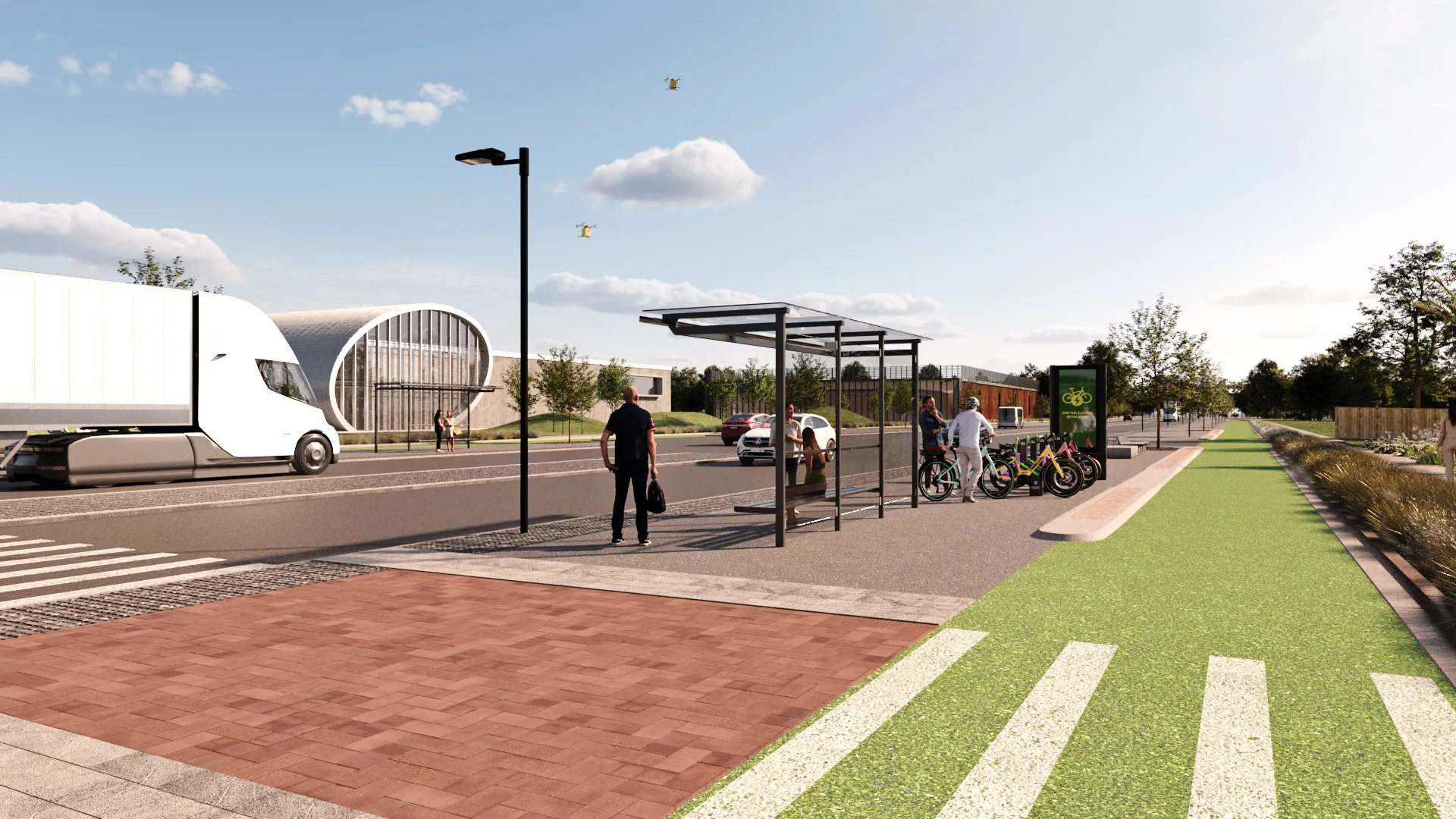
Spedding Road links Whenuapai’s emerging business precinct with the wider SH16 / SH18 corridor. Oyster Capital’s Spedding development includes industrial land, new roads, bridge upgrades and walking and cycling connections.
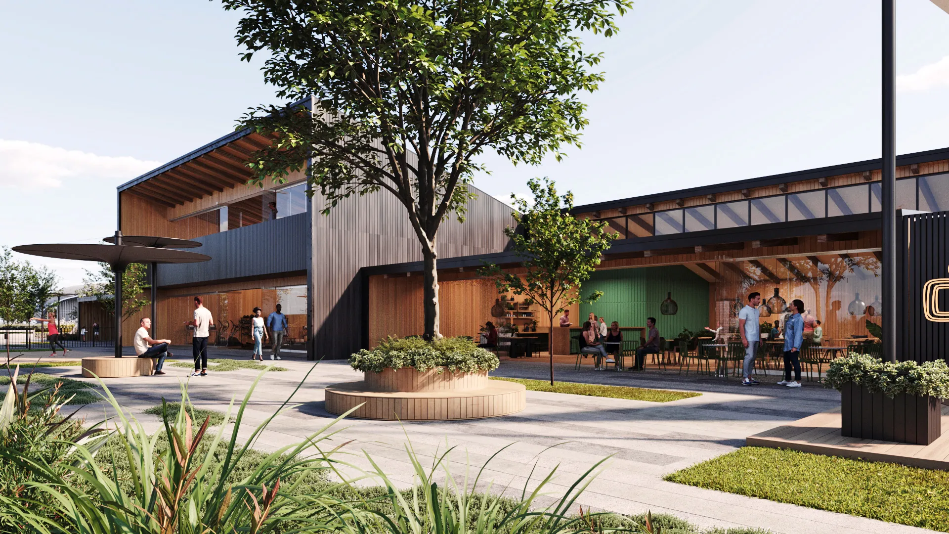
The nearby Spedding precinct adds a business and employment setting to Whenuapai. Its published architectural visuals explore workplaces, a café setting and landscaped spaces.
Nearby third-party development. These indicative renders do not confirm that the illustrated facilities are open, or form part of a Three Brothers project. Visuals: OTOH / Spedding Industrial. Image sources Disclaimer
These are separate places and developments in the surrounding area, not facilities within this site or Three Brothers developments. Proposed features and school zones may change. No travel-time or enrolment guarantees are made. Disclaimer
Map shows Hailes Road, Whenuapai. The site’s exact location and boundaries are not shown. Aerial images include neighbouring properties; capture dates and current site status are not established. Disclaimer